Jeju Olle Trail Guide — Which Course to Walk and What to Expect
Quick Answer
The Jeju Olle Trail (제주 올레길) is a 437km network of 27 walking routes that circles Jeju Island — and it costs nothing to walk. The courses follow Jeju’s coastline through fishing villages, volcanic lava fields, and cliffside paths. For first-time visitors, Course 6 (11km, easy, 3–4 hours) is the most approachable entry point, while Course 1 (15.1km, medium, 4–5 hours) delivers the classic Olle experience near Seongsan Ilchulbong. Both trailheads are accessible by public bus.
The Full Answer
The Jeju Olle Trail was created by Suh Myung-sook (서명숙), a journalist from Seogwipo (서귀포) who walked Spain’s Camino de Santiago in 2006 after retiring and returned determined to build something similar on her home island. The first course opened in 2007. By 2012, she had personally charted 21 routes, connecting broken paths, erecting markers, and threading together coastal roads, lava stone walls, and rural alleyways that most visitors to Jeju never encounter. Suh passed away in 2025 at age 68. The trail she created now receives millions of walkers each year and sparked a nationwide walking-trail movement across South Korea.
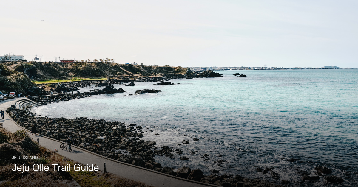
“Olle” (올레) is a Jeju dialect word for the narrow path connecting a main road to a house — a passageway between the public and the private. The name fits. The trail does not follow a mountain ridge or a single dramatic feature. It moves through the textures of actual Jeju life: haenyeo (해녀) dive villages, small fishing harbors, tangerine orchards, volcanic oreums (오름, parasitic volcanic cones), and stretches of black lava coastline where the surf hits the rocks without any railing between you and it.
This is not a mountain hike. There is no significant elevation gain on most courses, no permit system, and no park cut-off times. The pace is entirely your own. A comparison to Hallasan (한라산) is useful here — Hallasan is a summit challenge requiring 8–9 hours and strict entry deadlines, while the Olle Trail is a lateral journey at sea level. They serve different purposes and different fitness levels. Many visitors do both: Hallasan for the altitude and crater, Olle for everything else. More on that comparison in the FAQ below.
The trail passes through four UNESCO-designated ecosystems — alpine coniferous forest, warm temperate evergreen forest, temperate grassland, and coastal volcanic terrain. That range is the reason 27 courses can feel genuinely different from each other even on the same island.
The Courses: How the Trail Is Structured
The full trail consists of 21 primary numbered routes (Courses 1–21) forming a connected loop around Jeju, plus 6 sub-routes designated for outlying islands or alternate sections — including Course 1-1 on Udo Island (우도) and Course 10-1 on Gapa Island (가파도). Udo has its own rules about what you can bring across on the ferry, and they changed twice in 2026. Together: 27 routes, 437km.
Course lengths range from 4.3km (Course 10-1 on Gapa Island, the shortest) to 20.9km (Course 3-A, the longest). The average is approximately 16km per course. Typical walking time is 4–7 hours depending on pace and how often you stop.
Difficulty is broadly rated on a three-tier scale. Easy courses (like Course 6) have minimal elevation change and pass through populated areas with cafés and convenience stores. Medium courses (like Courses 1 and 7) include short climbs over oreums or exposed coastal sections. Hard designations are rare — the Olle Trail is not a technical trail, and most people of average fitness can complete any course without prior training.
The routes are mostly point-to-point rather than loops, meaning the start and end points are different. This is relevant for bus planning — you finish at Point B and need transport back. Kakao Maps (카카오맵) shows the entire Olle route as a dotted blue line overlay, which makes planning logistics straightforward.

Best Courses for First-Time Visitors
Course 6 — The Easiest Introduction (11km)
Course 6 runs 11km, takes 3–4 hours at a moderate pace, and is rated easy — the gentlest course on the entire trail. It passes through the center of Seogwipo city, which means waterfalls, cafés, small restaurants, and cultural sites are distributed along the route rather than concentrated at the start or end. The course ends at the Jeju Olle Tourist Center (제주 올레 여행자 센터), which is the official trail headquarters and the only location where you can claim a completion certificate after finishing all 27 courses.
One detail worth knowing: Course 6 is the home of the free English Walking Mate Program, which runs every Saturday morning at 09:30. Local volunteers pair up with international visitors and walk the full course as guides. No reservation is required, and there is no fee. For a first-time Olle walker who wants orientation — on the trail markers, the passport system, the local landscape — this is a practical resource that most travel guides underreport.
Course 6 is the right choice for half-day walkers, families traveling with children, or anyone who wants to assess whether the Olle format appeals to them before committing to a longer course.
Course 1 — The Classic Route (15.1km)
Course 1 is the official starting point of the entire Olle circuit. It runs 15.1km from Siheung (시흥리) to Gwangchigi Beach (광치기해변), takes 4–5 hours at a steady pace, and is rated medium difficulty.
The course passes through oreum (parasitic volcano) fields, including Al-Oleum (알오름), which offers wide-angle views over the eastern coast. It moves through the mural village of Jongdal-ri (종달리) and ends at Gwangchigi Beach with Seongsan Ilchulbong (성산일출봉) rising directly from the sea in the near distance. The combination of landscape variety — oreums, coastal road, village paths, tidal flats — is why Course 1 is considered the representative Olle experience.
If you are visiting Seongsan Ilchulbong separately, this course pairs well with it: walk Course 1, then climb Seongsan Ilchulbong the same afternoon or the following morning. More on timing for Ilchulbong is covered in How to Visit Seongsan Ilchulbong in Jeju.
Course 1 is the right starting point for walkers who want a genuinely representative Olle experience and have 4–5 hours available — or who plan to pair the walk with a Seongsan Ilchulbong visit on the same day.
Course 7 — The Dramatic Coastline (17.6km)
Course 7 covers 17.6km along the southern coast, takes 5–6 hours, and stands out for the variety of scenery packed into a single day’s walk. It starts at Oedolgae Rock (외돌개) — a 20-meter solitary sea stack formed from volcanic basalt — and continues past haenyeo dive villages at Beophwan-pogu (법환포구), the Subong-ro ecology path, and a section where freshwater meets the sea at Soggol (속골). The southern coastline here involves more exposure to the ocean than the eastern routes, with fewer sections through populated urban areas.
One important note: Course 7 has been partially modified in 2026 due to ongoing road construction, and it no longer connects directly to the end of Course 8. Check www.jejuolle.org for the current detour map before walking this course. The core sections — including Oedolgae and the haenyeo village stretch — are unaffected, but the endpoint logistics have changed.
Course 7 is the right choice for walkers with a full day available who want the most varied southern coastline on the trail — not the best starting course for first-time Olle walkers, given the 17.6km distance and the current route modifications.
Course 10-1 — Gapa Island (4.3km, ferry required)
Gapa Island (가파도) is Korea’s southernmost inhabited island, and Course 10-1 is the shortest Olle route at 4.3km. The walk is flat and takes 1.5–2 hours. The landscape is unlike anything on the main island: low stone walls separating barley fields, no cars, near-360-degree ocean views, and a population of under 200 people.
Getting there requires a ferry from Moseulpo Port (모슬포항), approximately 1.5 hours from Jeju City by bus (Bus 100 or Bus 200). The ferry crossing takes about 10 minutes. The combination of the ferry passage, the flat walk, and the relative emptiness makes this a noticeably different experience from the main-island courses — quieter, and more genuinely remote despite the short distance.
Course 10-1 is the right choice for day-trippers who want something compact and distinct — less about scenery variety, more about the unusual experience of walking Korea’s southernmost inhabited island with under 200 residents.
The Olle Passport and Stamp System
The Olle Passport (올레 여권) is an optional paper booklet that costs ₩20,000 (as of 2026). It is available at the Jeju Olle Tourist Center in Seogwipo, at the information desk at Jeju International Airport (located directly opposite the domestic arrivals exit), and at most trailhead information kiosks.
The system works as follows: at the start, midpoint, and end of each course, there is an unmanned stamp station called a Ganse (간세) — a small metal figure shaped like the Jeju horse (돌토리기, the trail’s official mascot). Each station holds an ink stamp with a unique design for that course. Collect all three stamps per course, complete all 27 courses, and bring your completed passport to the Jeju Olle Tourist Center in Seogwipo for verification. A certificate is issued at no additional cost; an optional completion medal costs an extra ₩5,000 (as of 2026).
A 100km partial completion certificate is also available, which is more relevant for visitors walking only a few courses.
The passport doubles as a discount card: passport holders receive reductions at select guesthouses, restaurants, and attractions along the trail.
Walking without a passport is perfectly fine — the trails are free and the stamps are optional. The passport is worth getting if you plan to walk more than two or three courses, or if the collection element adds something to the experience for you.

How to Get to the Trailheads Without a Car
All main Olle trailheads are reachable by public bus. No rental car is needed, and the bus network is straightforward once you understand two routes.
Bus 201 runs along the east coast, serving trailheads for Courses 1, 2, 3, and parts of Course 18. From Jeju City bus terminal, take Bus 201 and alight at Siheungni (시흥리) for Course 1 — a 5-minute walk from the stop to the trailhead.
Bus 202 covers the west coast, serving trailheads for Courses 9, 10, 12, and several others in that cluster.
For Gapa Island (Course 10-1), take Bus 100 or Bus 200 from Jeju City to Moseulpo, then walk to the ferry terminal. The bus ride takes approximately 1.5 hours.
The simplest payment method is a T-Money card (티머니카드), available at any convenience store (GS25, CU, 7-Eleven) for ₩3,000 (as of 2026). Load ₩10,000 to start and top up as needed. The card works on all Jeju buses and most taxis.
For planning, Naver Maps (네이버 지도) and Kakao Maps both support English-language search and show real-time bus schedules. Kakao Maps specifically displays the Olle trail route as a dotted blue overlay, which makes it easy to confirm which bus stop to use for each trailhead.
Taxis are available via the Kakao T app (카카오 T). A ride from Jeju City to most eastern trailheads costs approximately ₩15,000–₩30,000 (as of 2026). Taxis are faster and more useful for early-morning starts when bus frequency is lower, or for getting back from a course endpoint if the next bus is inconvenient.
Since courses are point-to-point, the standard approach is: bus to the start, walk, then bus or taxi from the end. Backtracking is rarely necessary.
A more detailed breakdown of Jeju’s public transport options — including how to navigate between different parts of the island — is in Visiting Jeju Island Without a Car.
What to Wear and Bring
The Olle Trail does not require specialized hiking gear. Comfortable trainers with decent grip are adequate for most courses. Waterproof hiking shoes are useful on courses with exposed coastal basalt sections — the lava rock is uneven and can be slippery after rain — but are not strictly necessary for Course 6 or Course 10-1.
Layering is practical regardless of season. Jeju’s coastal wind can drop the apparent temperature significantly even on warm days, and the island receives significant rainfall year-round. A lightweight waterproof jacket — compact enough to fit in a daypack — is the single most useful item to carry.
Sun protection matters on the longer coastal sections, which can have minimal shade for stretches of an hour or more. A hat and sunscreen are worth including from April onward.
Water: most courses pass through towns or convenience stores at regular intervals, so carrying 1–1.5 liters is sufficient for most people. Courses that pass through longer rural stretches (parts of Courses 3 and 4) benefit from carrying more.
Cash in the range of ₩10,000–₩20,000 (as of 2026) covers trailside café stops and small restaurants along the way. Most convenience stores also accept card, but smaller family-run spots may not.
What You Need to Know
-
Best seasons are spring and autumn. Late March to mid-May brings mild temperatures (13–20°C), cherry blossoms, and canola flower fields along several courses. Mid-September to mid-November is the other optimal window — stable weather, 11–18°C, and fewer visitors than spring. July and August are the months to avoid: monsoon rains (장마) make the paths slippery, heat and humidity reduce the enjoyment significantly, and this is also peak domestic tourism season.
-
Course 7 is modified in 2026. Road construction has altered the route and broken the direct connection to Course 8’s end point. The most visually compelling sections — Oedolgae Rock and the haenyeo coastline — remain intact, but check www.jejuolle.org for the current detour map before you go.
-
The English Walking Mate Program runs every Saturday on Course 6. It starts at 09:30, costs nothing, and requires no reservation. Local volunteer guides walk the full course with international visitors. A Sunday version on Course 18 (Jeju City area) is also available in English at the same time. This program is genuinely useful for first-time Olle walkers, particularly those who want context about the trail’s history and the landscape features along the way.
-
The passport is optional, not required. You can walk any course at any time without it. Buy it at the airport on arrival if you want it from day one.
-
Guesthouses along the trail are inexpensive but fill up in peak season. Minbak (민박) guesthouses in trail towns typically run ₩30,000–₩60,000 per night (as of 2026). Book 2–3 weeks ahead for April–May and October–November visits.
-
The official app is Korean only. The Olle Pass app (올레패스) includes GPS tracking and proximity alerts for stamp stations, but operates in Korean and requires a Korean phone number for some features. Kakao Maps and Naver Maps are both available in English and sufficient for navigation.
Practical Tips
-
Pick up the Olle Passport at the airport, not at the trailhead. The information desk at Jeju International Airport (opposite domestic arrivals) sells the passport and can answer basic questions immediately on arrival. Buying it at the trailhead means an extra errand on the day you walk.
-
Start Course 6 on a Saturday at 09:30 if this is your first Olle walk. The English Walking Mate Program departs from the Course 6 start point in Seogwipo. No advance booking required. Walking with a local guide for your first course makes the marker system, the stamp stations, and the geography of the trail much clearer before you walk independently.
-
Use Kakao Maps for the trail route, Naver Maps for bus times. Kakao Maps shows the Olle trail as a dotted blue overlay — useful for seeing your position on the course. Naver Maps has more reliable real-time bus information and lets you plan connections from course endpoints.
-
Load ₩30,000 onto your T-Money card before leaving Jeju City. This covers multiple bus rides and a taxi if needed. Cards are topped up at any convenience store — no language required, as the machines have English-language options.
-
Check jejuolle.org for closures before walking Course 7 or Course 10. Course 7 has 2026 construction modifications, and the Yongmeori Coast section of Course 10 closes periodically during high tide. Both closures are posted on the official site.
-
Plan the Gapa Island day trip around the ferry schedule, not the walk. The walk takes under 2 hours; the ferry and bus logistics take most of the day. Ferries from Moseulpo run on a fixed schedule — check times at the port or via visitjeju.net the evening before.
-
The course endpoint and the nearest accommodation are often not the same place. Most Olle courses end at a beach or coastal point rather than a town center. Look up the nearest guesthouse cluster before you walk, not after you arrive tired at the end point.
Frequently Asked Questions
Is the Jeju Olle Trail free to walk?
Yes. Walking any of the 27 courses costs nothing. The Olle Passport (₩20,000 as of 2026) is an optional add-on for stamp collection and certificate purposes. It is not required to access any section of the trail.
How many days do you need for the Jeju Olle Trail?
To complete all 27 courses, allow a minimum of 21 days — one course per day on the main routes — with 26–30 days more realistic if you include rest days and the outlying island routes (Udo, Gapa, Chuja). Most visitors walk 1–3 individual courses during a standard Jeju trip. One or two courses are fully achievable within a 3–5 day itinerary.
Can I walk the Jeju Olle Trail without a car?
Yes. Bus 201 (east coast) and Bus 202 (west coast) cover nearly all main trailheads. A T-Money card is the easiest payment method. Kakao T handles taxis for trailhead access or returns from course endpoints.
What is the easiest Jeju Olle Trail course for beginners?
Course 6 is the most accessible — 11km, easy rating, flat terrain, and passing through Seogwipo city with regular café and rest stops. Course 10-1 on Gapa Island (4.3km, flat) is shorter but requires a ferry. Both are appropriate for walkers who do not have regular hiking experience.
What is the best season to walk the Jeju Olle Trail?
Spring (late March to mid-May) and autumn (mid-September to mid-November) offer the best conditions — mild temperatures, lower rainfall, and either wildflowers or foliage depending on the season. July and August should be avoided: monsoon rains, high humidity, and peak domestic tourist traffic make the experience significantly less comfortable.
Jeju Olle Trail vs. Hallasan — which should I prioritize?
They are not competing options. Hallasan is a single-day summit hike requiring 8–9 hours and strict park entry deadlines — it demands preparation and a full day of physical effort. The Olle Trail is a multi-course coastal walk that can be done in half-day segments with no entry requirements. If you have 3–5 days on Jeju, doing both is practical: Hallasan on one day, an Olle course on another. More on the Hallasan experience is in How to Hike Hallasan in Jeju.
Related Questions
- How to Hike Hallasan in Jeju — Trails, Reservations, and What to Expect
- Visiting Jeju Island Without a Car — Bus Routes, Taxis, and Getting Around
- Jeju Island Itinerary: 3-Day and 5-Day Options for First-Timers